Do you Remember March 11, 2011?
March 11, 2011: A magnitude 9.0 earthquake struck Japan, triggering a massive tsunami. The government of Japan estimated that in March 2012, the tsunami had swept about 5 million tons of debris into the ocean, and about 70% of it had sunk quickly. The remaining debris was dispersed far across the North Pacific, an area of ocean roughly three times the size of the lower 48 states. Some debris reached the west coast of the US and Canadian shores.
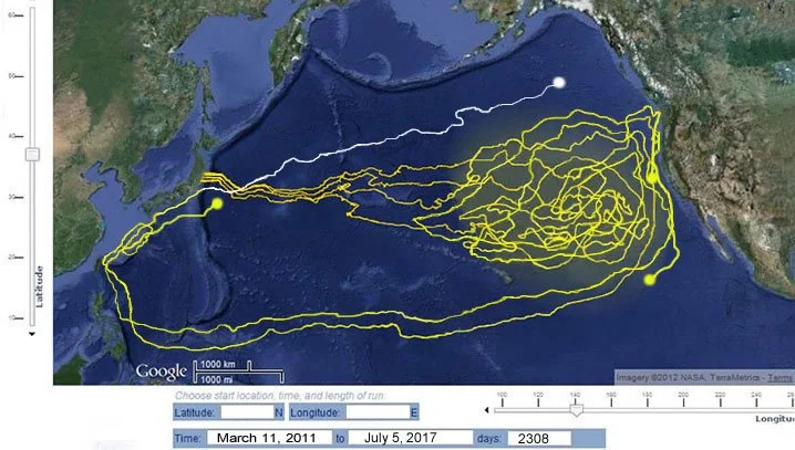
Naoko Art and our Nonprofit Organization, Islands4Kids.org, conducted Japan tsunami-related marine debris research and simulation for six years and nine months until April 2018. We created the month-by-month course simulation animation on Google Maps, referencing NOAA's Ocean Current Simulator (OSCURS) data.
This simulation record demonstrates a broad stroke and projection of how the tsunami-related marine debris traveled the Pacific Ocean.
Through our monthly marine debris trajectory predictions, we can revalidate the Kuroshio (Black Current) general gyre course in the Northern Pacific Ocean.
We can also visualize the physical mechanism of how marine debris accumulates as what is known as the "Garbage Patch" in the middle of the Northeastern Pacific Ocean. The vortex activities of many branched-off currents create it.

